• Willkommen im Geoclub - dem größten deutschsprachigen Geocaching-Forum. Registriere dich kostenlos, um alle Inhalte zu sehen und neue Beiträge zu erstellen.

modifizierter gpx export

snaky

Geowizard
Falls Du auf der Fehlersuche bist, warum das mit den POI nicht geht:
Code:
gpsbabel -s -i geo -f temp.loc -o garmin -F usb:
geht bei mir einwandfrei,
Code:
gpsbabel -s -i geo -f temp.loc -o garmin_poi-F usb:
erstellt dagegen nur eine Datei mit dem Namen "usb:"

Möglicherweise ist das also ein gpsbabel (1.3.5) Problem.

Ansonsten schon mal: Danke. :)
 
OP
G

greiol

Geoguru
snaky schrieb:
Falls Du auf der Fehlersuche bist, warum das mit den POI nicht geht:
noe, ich habs noch gar nicht eingebaut ;) . das mit den poi ist auch etwas trickreicher als in deinem beispiel (wenn es gut aussehen soll). fehlt da nicht ein leerzeichen vor dem -F?
 

Wutschkow

Geomaster
greiol schrieb:
ah, die die windows und die java version reagieren scheinbar mal wieder unterschiedlich :motz:
*Seufz* - Das Problem kenne ich...
greiol schrieb:
sollen wir zurück zum alten symbol?
Naja, zumindest sollte es bei Linux und Windows wieder einheitlich sein, oder?
Ansonsten ist das neue Symbol auch nicht schlecht, aber das alte war etwas "sprechender" (vielleicht auch nur Macht der Gewohnheit) und das Panel sah damit insgesamt etwas einheitlicher aus, finde ich.
 

Geo-Johnny

Geowizard
Wutschkow schrieb:
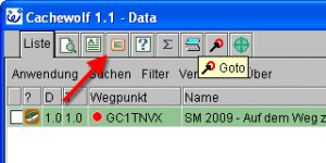
Ähh ... das "images.gif" (siehe zwei Posts weiter oben) wird für die Bilder-Schaltflächen in den CW-Panels benutzt.
War das wirklich Absicht, das die jetzt anders aussehen? :???:
@Wutschkow
Kannst Du mir das näher erklären?
Mir ist nur aufgefallen wenn die "images.gif" im CW Verzeichnis(in den Datfles) fehlt, dann wird im Browser Offline Betrieb das Icon nicht angezeigt.
Leicht möglich, daß ich in meinem Übereifer unabsichtlich etwas vermurkst habe, wenn der Dateiname schon irgendwo anders verwendet wird.
Aja, ich arbeite nicht mt der JAVA Version, sondern nur W32 und PPC.

Edit: Aha, habe es gerade oben gelesen und was machen wir nun?
 
OP
G

greiol

Geoguru
das sind die "Needs Archived" logs. da fehlt tatsächlich das symbol und wird nachgeliefert.
 
OP
G

greiol

Geoguru
Wer sich eine Datei mit dem Name GarminPOI.zip baut, darin passende bmp files ablegt und sie ins cachewolf verzeichnis legt, bekommt die nun auch brav mit ausgepackt, wenn er mit "seperate files" exportiert (vorschläge für ein besseres verfahren werden gerne entgegen genommen).

passend bedeutet in diesem zusammenhang: für poiid="Klettern" sollte Klettern.bmp drin sein.

geeignete symbole kann man sich mit paint oder gimp selber erstellen. 8-bit farbtiefe, bmp format, transparent ist R/G/B 255/0/255

als nächstes basteln wir dann daraus noch automatisch die GPI dateien,
 

t31

Geowizard
Gerade eben habe ich die neue Funktionalität getestet.

Erstmal: nice :gott:
Die Zuordnung klappt perfekt bei den Hauptwegpunkten (Tradi, Multi, etc.pp.).

Die AWP machen aber Probleme bei Einzel-Export (je Typ eine Datei) und werden nicht exportiert, also kein Parkplatz, kein Multistation, keine QtA, keine Referenzpunkt etc.pp.:
Code:
...
02.07.2009/01:35: unmatched POI ID for AH1TMFW

02.07.2009/01:35: unmatched POI ID for AI1TMFW

02.07.2009/01:35: GPX Export: warning GarminPOI.zip not found
ewe.io.IOException: Can't read file.

und auch, wenn alles nur in eine Datei exportiert wird:
Code:
02.07.2009/01:35: Error reading garminmap.xml: 
Document contains illegal control character with value 0

02.07.2009/01:35: unmatched POI ID for FI1TG49

...

02.07.2009/01:35: unmatched POI ID for AH1TMFW

02.07.2009/01:35: unmatched POI ID for AI1TMFW

02.07.2009/01:35: GPX Export: warning GarminPOI.zip not found
ewe.io.IOException: Can't read file.

02.07.2009/01:40: Error reading garminmap.xml: 
Document contains illegal control character with value 0
In Mapsource werden alle WP dargestellt, die AWP haben aber das Default-Cachertruhe-Symbol und nicht wie zu erwarten wäre, Parkplatz, Referenzpunkt ...
Bei den Cachetypen selbst (Tradi, Multi, ... ), klappt es wunderbar.


meine garminmap.xml
Code:
<?xml version="1.0" encoding="ISO-8859-1"?>
<iconmap>

<icon name="Custom 18" type="2" found="1" poiid="found"/>
<icon name="Custom 18" type="3" found="1" poiid="found"/>
<icon name="Custom 18" type="4" found="1" poiid="found"/>
<icon name="Custom 18" type="5" found="1" poiid="found"/>
<icon name="Custom 18" type="6" found="1" poiid="found"/>
<icon name="Custom 18" type="8" found="1" poiid="found"/>
<icon name="Custom 18" type="11" found="1" poiid="found"/>
<icon name="Custom 18" type="13" found="1" poiid="found"/>
<icon name="Custom 18" type="101" found="1" poiid="found"/>
<icon name="Custom 18" type="104" found="1" poiid="found"/>

<icon name="Custom 15" type="2" status="Nacht" poiid="night"/>
<icon name="Custom 15" type="3" status="Nacht" poiid="night"/>
<icon name="Custom 15" type="8" status="Nacht" poiid="night"/>

<icon name="Custom 16" type="2" status="LP" poiid="lp"/>
<icon name="Custom 16" type="3" status="LP" poiid="lp"/>
<icon name="Custom 16" type="8" status="LP" poiid="lp"/>

<icon name="Custom 12" type="2" terrain="5" poiid="tradi"/>
<icon name="Custom 12" type="2" terrain="4.5" poiid="tradi"/>
<icon name="Custom 12" type="2" terrain="4" poiid="tradi"/>
<icon name="Custom 6" type="2" size="M" poiid="tradi"/>
<icon name="Custom 0" type="2" poiid="tradi"/>

<icon name="Custom 13" type="3" terrain="5" poiid="Multi"/>
<icon name="Custom 13" type="3" terrain="4.5" poiid="Multi"/>
<icon name="Custom 13" type="3" terrain="4" poiid="Multi"/>
<icon name="Custom 7" type="3" size="M" poiid="Multi"/>
<icon name="Custom 1" type="3" poiid="Multi"/>

<icon name="Custom 5" type="4" poiid="Virtual"/>

<icon name="Custom 3" type="5" poiid="Letterbox"/>

<icon name="Custom 11" type="6" poiid="EVENT"/>

<icon name="Custom 14" type="8" terrain="5" poiid="Mystery"/>
<icon name="Custom 14" type="8" terrain="4.5" poiid="Mystery"/>
<icon name="Custom 14" type="8" terrain="4" poiid="Mystery"/>
<icon name="Custom 8" type="8" size="M" poiid="Mystery"/>
<icon name="Custom 2" type="8" poiid="Mystery"/>

<icon name="Custom 4" type="11" poiid="Webcam"/>

<icon name="Custom 19" type="12" poiid="Locationless"/>

<icon name="Custom 10" type="13" poiid="CITO"/>

<icon name="Geocache" type="101" poiid="Wherigo"/>

<icon name="Custom 9" type="104" poiid="Earthcache"/>

<icon name="Parking Area" type="50" poiid="P"/>

<icon name="Custom 22" type="51" poiid="S"/>

<icon name="Custom 20" type="52" poiid="Q"/>

<icon name="Civil" type="53" poiid="F"/>

<icon name="Custom 21" type="54" poiid="T"/>

<icon name="City (Medium)" type="55" poiid="R"/>
</iconmap>
 
OP
G

greiol

Geoguru
t31 schrieb:
Code:
02.07.2009/01:35: Error reading garminmap.xml: 
Document contains illegal control character with value 0
der regelsatz ist in ordnung, aber der mag die datei an sich nicht.

lösch sie mal, leg eine neue an und kopier den letzen teil des postings wieder rein.
 

Geo-Johnny

Geowizard
t31 schrieb:
<?xml version="1.0" encoding="ISO-8859-1"?>
<iconmap>

<icon name="Custom 18" type="2" found="1" poiid="found"/>
<icon name="Custom 18" type="3" found="1" poiid="found"/>
<icon name="Custom 18" type="4" found="1" poiid="found"/>
<icon name="Custom 18" type="5" found="1" poiid="found"/>
<icon name="Custom 18" type="6" found="1" poiid="found"/>
<icon name="Custom 18" type="8" found="1" poiid="found"/>
<icon name="Custom 18" type="11" found="1" poiid="found"/>
<icon name="Custom 18" type="13" found="1" poiid="found"/>
<icon name="Custom 18" type="101" found="1" poiid="found"/>
<icon name="Custom 18" type="104" found="1" poiid="found"/>

<icon name="Custom 15" type="2" status="Nacht" poiid="night"/>
<icon name="Custom 15" type="3" status="Nacht" poiid="night"/>
<icon name="Custom 15" type="8" status="Nacht" poiid="night"/>

<icon name="Custom 16" type="2" status="LP" poiid="lp"/>
<icon name="Custom 16" type="3" status="LP" poiid="lp"/>
<icon name="Custom 16" type="8" status="LP" poiid="lp"/>

<icon name="Custom 12" type="2" terrain="5" poiid="tradi"/>
<icon name="Custom 12" type="2" terrain="4.5" poiid="tradi"/>
<icon name="Custom 12" type="2" terrain="4" poiid="tradi"/>
<icon name="Custom 6" type="2" size="M" poiid="tradi"/>
<icon name="Custom 0" type="2" poiid="tradi"/>

<icon name="Custom 13" type="3" terrain="5" poiid="Multi"/>
<icon name="Custom 13" type="3" terrain="4.5" poiid="Multi"/>
<icon name="Custom 13" type="3" terrain="4" poiid="Multi"/>
<icon name="Custom 7" type="3" size="M" poiid="Multi"/>
<icon name="Custom 1" type="3" poiid="Multi"/>

<icon name="Custom 5" type="4" poiid="Virtual"/>

<icon name="Custom 3" type="5" poiid="Letterbox"/>

<icon name="Custom 11" type="6" poiid="EVENT"/>

<icon name="Custom 14" type="8" terrain="5" poiid="Mystery"/>
<icon name="Custom 14" type="8" terrain="4.5" poiid="Mystery"/>
<icon name="Custom 14" type="8" terrain="4" poiid="Mystery"/>
<icon name="Custom 8" type="8" size="M" poiid="Mystery"/>
<icon name="Custom 2" type="8" poiid="Mystery"/>

<icon name="Custom 4" type="11" poiid="Webcam"/>

<icon name="Custom 19" type="12" poiid="Locationless"/>

<icon name="Custom 10" type="13" poiid="CITO"/>

<icon name="Geocache" type="101" poiid="Wherigo"/>


<icon name="Custom 9" type="104" poiid="Earthcache"/>

<icon name="Parking Area" type="50" poiid="P"/>


<icon name="Custom 22" type="51" poiid="S"/>

<icon name="Custom 20" type="52" poiid="Q"/>

<icon name="Civil" type="53" poiid="F"/>


<icon name="Custom 21" type="54" poiid="T"/>

<icon name="City (Medium)" type="55" poiid="R"/>

</iconmap>
:???:
Klappt es, wenn Du bei den rot Markierten testweise Custom Icons verwendest?
Zur Zeit kann ich es selbst nicht testen, aber vielleicht hat es etwas mit den Anführungszeichen zu tun?
Normalerweise sollte das schon so klappen, ich selbst verwende NUR Custom Symbole, da es Unterschiede bei den Garmin Geräten und auch zwischen MapSource alt und neu in der internen Reihung der Standardsymbole gibt!
 

t31

Geowizard
@ greiol
heiliger Streuselkuchen ... er mag tatsächlich die Datei nicht, es lag aber an etwas anderem

Code:
...

<icon name="Geocache" type="101" poiid="Wherigo"/>

...

es liegt an früher, das hatte ich mal reingeschrieben und machte bisher keine Probleme, interessant das er sich am Kommentar verhaspelt.

Die 2 üs wurden umweltschonend eliminiert und nun funktioniert es wunderbar. :)
 
OP
G

greiol

Geoguru
t31 schrieb:
Die 2 üs wurden umweltschonend eliminiert und nun funktioniert es wunderbar. :)
der xmlparser macht leider nicht immer so ganz das was man von ihm erwartet. aber es freut ich dass es nun klappt.

ich werde mal einen entsprechenden Hinweis in die nächste Version der Doku aufnehmen.
 

Geo-Johnny

Geowizard
@greiol
Also ich habe das heute mit den "custom icons" und den "one file per type" mal getestet, läuft einfach fantastisch. Das mit der GarminPOI.zip ist auch ein Hammer. ;)
ABER:
Es muß die "GarminPOI.zip" im CW Verzeichnis zu finden sein, sonst kommt dieser Fehler im log.txt:
02.07.2009/17:32: GPX Export: warning GarminPOI.zip not found
ewe.io.IOException: Can't read file.
... was ich für mich als großen Nachteil sehe, weil ich für zwei verschiedene Garmin Geräte die Icons in zwei unterschiedlichen Größen exportiere. Die Lösung wäre, wenn der Exporter die "GarminPOI.zip" dort sucht, wo man auch den Folder selectet hat! Dann könnte man nämlich verschiedene "GarminPOI.zip" in verschiedenen Ordnern anlegen. (oder auch beim CW Verzeichnis bleiben, je nach belieben)

Ich habe z.B. zwei verschiedene Ordner wo ich die POI's hinexportiere ...
GPSMap POI's
Nüvi POI's
Das habe ich deshalb gemacht, weil am Garmin Nüvi die 16x16 Icons winzig und fast nicht erkennbar sind. :/
Am Nüvi nehme ich die gleichen Icons, aber mit 22x22 ...
 
OP
G

greiol

Geoguru
mein derzeitigen ziele für den export sind
- brauchbares format (auch für die besitzer von haribos und pizza gewürzen ;) , aus der ecke fehlt mir noch feedback, vor allem zu multis)
- im kompakten export mehr informationen als bisher
- die möglichkeit direkt poi erzeugen zu können (ist erst halb fertig)
- merken der jeweils letzten einstellungen (bisher nur die loganzahl)
- mit MiK den MyFinds-Export verbessern

das ganze dann möglichst stabil und ohne bugs

danach kommen wieder zu den features
 
Oben